|
What's the signal?
GPS satellites
transmit two low power radio signals, designated L1 and L2.
Civilian GPS uses the L1 frequency of 1575.42 MHz in the UHF
band. The signals travel by line of sight, meaning they will
pass through clouds, glass and plastic but will not go through
most solid objects such as buildings and mountains.
A GPS signal contains
three different bits of information — a pseudorandom code,
ephemeris data and almanac data. The pseudorandom code is
simply an I.D. code that identifies which satellite is
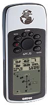
transmitting information. You can view this number on your GPS
unit's satellite page, as it identifies which satellites it's
receiving. The ephemeris data, which is constantly transmitted
by each satellite, contains important information about the
status of the satellite (healthy or unhealthy), current date
and time. This part of the signal is essential for determining
a position. The almanac data tells the GPS receiver where each
GPS satellite should be at any time throughout the day. Each
satellite transmits almanac data showing the orbital
information for that satellite and for every other satellite
in the system.
Sources of GPS signal errors
Factors that can
degrade the GPS signal and thus affect accuracy include the
following:
Ionosphere and
Troposphere Delays — The satellite signal slows as it
passes through the atmosphere. The GPS system uses a built-in
model that calculates an average amount of delay to partially
correct for this type of error.
Signal Multipath
— This occurs when the GPS signal is reflected off objects
such as tall buildings or large rock surfaces before it
reaches the receiver. This increases the travel time of the
signal, thereby causing errors.
Receiver Clock
Errors — A receiver's built-in clock is not as accurate as
the atomic clocks onboard the GPS satellites. Therefore, it
may have very slight timing errors.
Orbital Errors
— Also known as ephemeris errors, these are inaccuracies of
the satellite's reported location.
Number of
Satellites Visible — The more satellites a GPS receiver
can "see," the better the accuracy. Buildings, terrain,
electronic interference, or sometimes even dense foliage can
block signal reception, causing position errors or possibly no
position reading at all. GPS units typically will not work
indoors, underwater or underground.
Satellite
Geometry/Shading — This refers to the relative position of
the satellites at any given time. Ideal satellite geometry
exists when the satellites are located at wide angles relative
to each other. Poor geometry results when the satellites are
located in a line or in a tight grouping.
Intentional
Degradation of the Satellite Signal — Selective
Availability (SA) is an intentional degradation of the signal
once imposed by the U.S. Department of Defense. SA was
intended to prevent military adversaries from using the highly
accurate GPS signals. The government turned off SA in May
2000, which significantly improved the accuracy of civilian
GPS receivers.
Who
uses GPS?
GPS has a variety of
applications on land, at sea and in the air. Basically, GPS is
usable everywhere except where it's impossible to receive the
signal such as inside most buildings, in caves and other
subterranean locations, and underwater. The most common
airborne applications are for navigation by general aviation
and commercial aircraft. At sea, GPS is also typically used
for navigation by recreational boaters, commercial fishermen,
and professional mariners. Land-based applications are more
diverse. The scientific community uses GPS for its precision
timing capability and position information.
Surveyors use GPS for
an increasing portion of their work. GPS offers cost savings
by drastically reducing setup time at the survey site and
providing incredible accuracy. Basic survey units, costing
thousands of dollars, can offer accuracies down to one meter.
More expensive systems are available that can provide
accuracies to within a centimeter.
Recreational uses of
GPS are almost as varied as the number of recreational sports
available. GPS is popular among hikers, hunters, snowmobilers,
mountain bikers, and cross-country skiers, just to name a few.
Anyone who needs to keep track of where he or she is, to find
his or her way to a specified location, or know what direction
and how fast he or she is going can utilize the benefits of
the global positioning system.
GPS is now commonplace
in automobiles as well. Some basic systems are in place and
provide emergency roadside assistance at the push of a button
(by transmitting your current position to a dispatch center).
More sophisticated systems that show your position on a street
map are also available. Currently these systems allow a driver
to keep track of where he or she is and suggest the best route
to follow to reach a designated location. |